Plan Your Visit
How long should you stay here? When Tioga and Glacier point roads are closed and the sequoia groves are inaccessible during the winter months, spending one whole day here (that’s two nights - our shortest allowed reservation) is perfect. This allows guests to focus on having an entire day exploring the Valley. However, if you decide to stay on for more nights don’t worry: There are plenty of awesome opportunities in the Valley during the winter months to keep an avid hiker engaged for days.
From late spring through November a three night, two whole day visit is best because it will allow you one whole day to explore the valley and a second to experience the wonderful landscapes at the end of Glacier point road, both of which have substantial hiking opportunities. And of you plan your day right, a two day visit will also allow you to check out one the amazing groves of giant Sequoias.
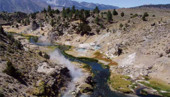
In the Eastern Sierra near Mammoth Lakes is Hot Creek, the fascinating thermal area shown in this photo.
For a full discovery of this beautiful mountain range you will need to schedule
in an additional day, or days, giving you a chance to explore many of the most
amazing landscapes in all of California!
And if you can add as many as 6 days you will also be able to experience all or
part of the awe inspiring Yosemite to Las Vegas tour where
you could be hiking in the alpine high country below a 15,000 foot peak, the
highest in the contiguous US, in the morning then a few hours later be standing
at the lowest spot in North America in Badwater, Death Valley National Park at
282 feet below sea level!
In this case, waking up from the third night of your visit to our inn, you
would then take a full day tour of the magnificent Tioga road, driving all the
way through the high country to the eastern Sierra. This will make it so you
will have with enough time during that drive not only for the many nice stops
along the way but also for a nice hike to some alpine lakes or an exploration
along a river looking for a cool swimming hole. That forth night would be spent
in the Lee Vining area. That next day, check out the abandoned old mining town
of Bodie, an awesome hike to Virginia lakes or check out the scenic Mono lake.
Next you would drive to and stay the fifth night in the town of Bishop. From
there spend the next day exploring the amazing Owens valley where you will see
extinct volcanoes, lava flows, and the towering peaks of the Sierra, including
the tallest in the contiguous US, Mount Whitney. Also along this route you will
pass by the Bristlecone Pine forest (the oldest trees in the world), a thermal
area (Hot Creek), the Lone Pine Fish Hatchery (great place for a picnic) and a
road that will take you to another great place for a hike or picnic at the base
of Mt Whitney: the Mt. Whitney Portal Road (which will also take you through the
amazing Alabama Hills). Spending the sixth night in the town of Lone Pine paves
the way for a direct route through the heart of Death Valley and on to Vegas.
Here is a link
detailing the route for the Yosemite to Vegas tour. Feel free to
contact us
for help with your advance planning - we love to help everyone to get
the most out of their visit to this amazing part of California!
When to Visit
Wintertime December - February
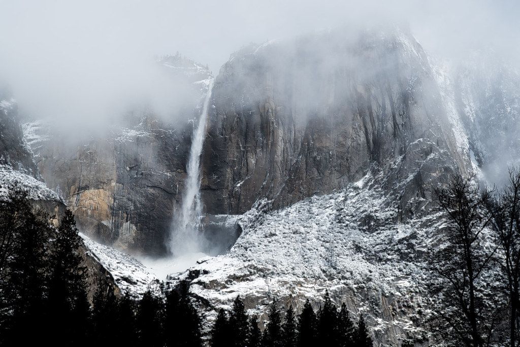
The winter is magical here, with the landscape turned white, with many opportunities for skiing, skating and other fun snow play. Some of the most awe inspiring moments in the mountains are to be found when a winter storm breaks! Note that the route 41 access to the park is often closed during winter months. Use the Ca. 140 route through Mariposa for "guaranteed" year round access to the valley floor. *Note: Tioga Pass road is closed after cold storms and during the winter months. For up to date information on road conditions visit this website or call 1(800)427-7623
Spring - late March through May
In some ways spring is the best time for travel here. Not only are there way fewer visitors, but the weather is cooler, the peaks are still covered in snow, the streams and waterfalls are booming and the large swaths of dry grasses in the lower elevation oak woodlands transform into rolling green pastures rife with wildflowers. Also, spring storms bring amazing weather throughout the area, especially when the weather breaks. The big limitation is that the higher elevations are not easily assessable, meaning many of the parks most amazing destinations are out of reach.
Summer & Fall
June to November
While summer offers access to all of Yosemite's expansive and awesome natural
landscapes, it is also the busiest with crowds growing on the weekends. That
being said, the time before the July 4th holiday during June can have al the
attributes of visiting during spring and summer, with smaller crowds, the water
features still in full effect with full access to everything the park has to
offer. But this is a a gamble since it is dependent on the high country
roads being cleared of snow and debris before the 4th.
Here is a link
to a listing of all the spring opening dates of the Tioga road since the 1950s.
Another trick is to plan your trip for when the crowds subside: the period
between labor day and mid November. During this time, the water features may be
at their lowest but the crowds are much smaller and everywhere else is yours to
explore.
What to pack . . .
Sturdy shoes, preferably hiking boots, with good treads, for hiking.
Hat for sun protection.
Long pants and socks for hiking in brush and where there might be poison oak.
Sunscreen - many areas do not have shade
Sunglasses
Insect repellent
A day pack for gear, an extra shirt or having a picnic while hiking
Binoculars - Even if you don't see any wildlife, watching those crazy rock climbers thousands of feet up on El Capitan is fascinating to watch'!
Wildlife guide
For traveling during off season, winter/rain apparel.
Topographic maps and compass - just in case!
Bathing suit in summer
Some people enjoy using a trekking pole.
Maps
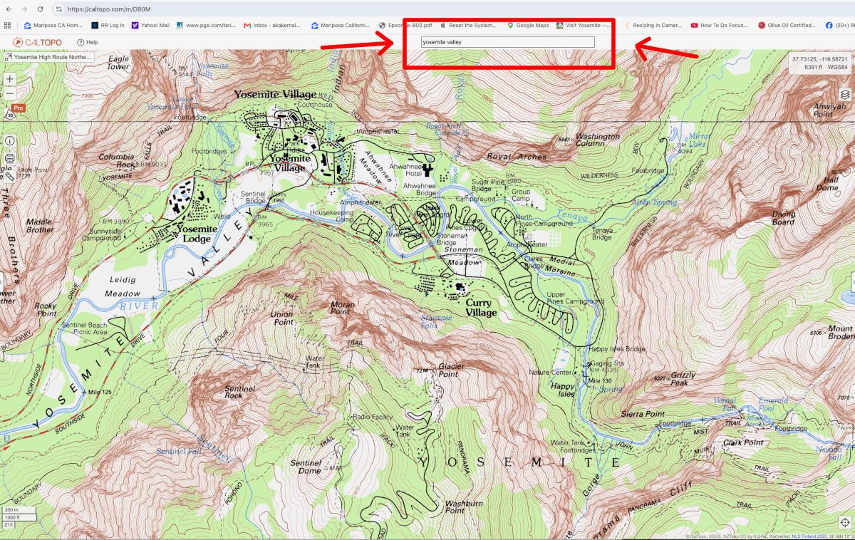
For a super detailed topographic map of both Yosemite Valley and the entirety of the Sierra Nevadas, go to the website for CalTopo and enter the place you want to research in the box as shown in the map above
This
park service page
has downloadable version of the official maps of the park
Here is
another map page
from the park service that has several topographic maps of the Yosemite
area as well as trail descriptions.
This map shows parts of Mariposa County, the town of Oakhurst, and vicinity.